The Cambrian Mountains |
|
The Cambrian Mountains |
|
|||
 |
|||
The most overlooked and underrated mountain range in Wales |
Listen to this article |
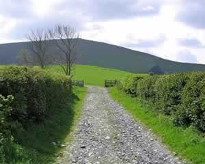
Wales is a nation that's crammed full of hills, slopes and peaks. The Cambrian Mountains are a large section of these in the centre of the country. They're sandwiched between the two better-known ranges in the Snowdonia and Brecon Beacons National Parks. |
 The Cambrian Mountain in Wales Photo by Dave Hamster |
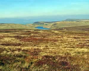
The landscape is made up of high plateaus and swooping valleys, filled with farms and forests. Within its 1300 square kilometre area, there are no notable settlements, and only one major road. It's so sparsely populated that it's nicknamed "the Green Desert of Wales". This name may seem a little dull, but it's appropriate in a way. To truly escape from urban life, this is the place to come. Once you've wandered into the hills, there might be no-one else for miles and miles. |
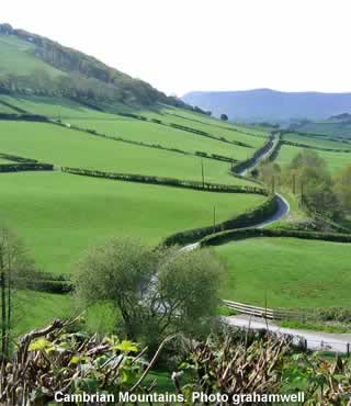
 A road snakes its way through the Cambrian Mountain in Wales Photo by Bladeflyer |
The slopes of the Cambrian Mountains are the starting point for many of Wales' rivers. Even the Severn, one of England's major waterways, has its origin here. |
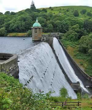
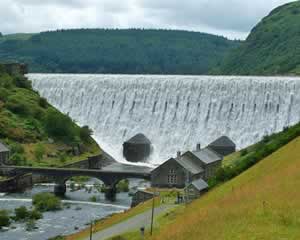
However, the most remarkable water feature in mid-Wales is arguably the series of reservoirs and dams inside the Elan Valley. They were created around 100 years ago, in the midst of the Industrial Revolution. Birmingham's population had increased vastly, and they desperately needed a large supply of clean water. The Elan Valley was identified as the perfect place to get it. This prompted the start of a huge construction project, involving around 50,000 workers and countless tonnes of building materials. It took over a decade for the water to finally begin flowing towards Birmingham. It's carried for 117 kilometres, along a very carefully constructed aqueduct. It slopes down at a barely noticeable gradient, so no pumps are required. The water is moved entirely by the force of gravity, at a speed of around 3 kilometres per hour. It takes a day and a half to make the journey, but it's worth it, as Elan's water is extremely soft and clean. |
 Water in the Elan Valley Photo by blackadderajr |
The most popular way to explore the reservoirs and dams is via the Elan Valley Trail. This 13-kilometre path follows the route of a disused railway line. Its properly paved surface is suitable for everyone, from walkers, to cyclists, to wheelchair users. The information boards along its length give you various facts about the area, and the benches give you a chance you catch a breather. |
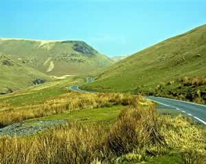
 A walking trail in the Cambrian Mountain Photo by grahamwell |
If you prefer, the valley has plenty of other, more challenging hikes. There are 128 kilometres of official trails, where the public has right of way. For more information, there's a visitor centre in the valley with routes and maps. It also has details of the local wildlife - of which there's plenty. There are many different kinds of birds here, including several of Britain's rarest species. If you're lucky or patient, you'll also be able to catch sight of mammals like otters or stoats. |
 The Caban Coch Dam the Elan Valley Photo by blackadderajr |
At one time, the Cambrian Mountains were due to become a National Park themselves. However, in the 70s, the proposal was unexpectedly rejected. For this reason, the area can sometimes be overshadowed by Snowdonia and the Brecon Beacons, which did become official National Parks. However, one trip to the Cambrian Mountains will make it obvious that they are still without doubt breath-taking. |
 |
|
Pocket Britain is optimised for use on a smartphone or tablet with internet access. All content is subject to copyright. All reasonable methods have been used to ensure information supplied is accurate at the time of publication. However, it is advisable to check information before relying on it. Privacy Policy |