Ennerdale Water |
|
Ennerdale Water |
|
|||
 |
|||
Britain > Lake District > Ennerdale Water |
|||||
The westernmost lake in the Lake District National Park |
|||||
Listen to this article |
|||||
|
|||||
Ennerdale Water is the furthest west of all Cumbria's lakes. It's quite tricky to get to as the access roads are narrow, twisted and hard to navigate. This remoteness makes it one of the quietest places in the Lake District. This is even true in the summer, when lakes like Windermere are covered in swarms of visitors. |
|||||
Even if you make the journey it's difficult to stay longer than a single day, as Ennerdale has no hotels and no restaurants. There are a couple of hostels, but these are only accessible on foot. They're probably among the most remote places to stay in the whole of England. One in particular, the Black Sail Hostel, is literally just a single hut in the middle of nowhere. |
|||||
A kilometre or so to the west of the lake is a village called Ennerdale Bridge. It's only a small place, but it's worth stopping by if you're passing. There are a couple of pubs, where you can pick up a bit of food or drink. |
|||||
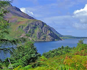
For many years Ennerdale Water has been used as a reservoir, serving over 30,000 customers a day. This means that its water is remarkably clear and pure. The only craft allowed onto the lake are kayaks and canoes, and even then you need a permit. |
|||||
Unlike most lakes, there is no established path running around Ennerdale's perimeter. It is possible to make the circuit, but parts of the route can be unstable and dangerous. The entire circumference is 13 kilometres long, which can be completed in around 3 hours. |
|||||
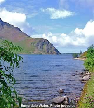
 The view over Ennerdale Water Photo judepics |
|||||
There are plenty more walking opportunities inside Ennerdale Forest. It's one of the biggest woods in the county, with over 30 kilometres of forest roads, and dozens of other paths and trails. Hundreds of new trees were planted here from as early as the 30s. These were arranged in unnatural-looking straight rows, a decision that prompted criticism at the time. Nevertheless, there's still some fantastic scenery to gawk at. Along your way, keep an eye out for creatures like deer, red squirrels and herons. |
|||||
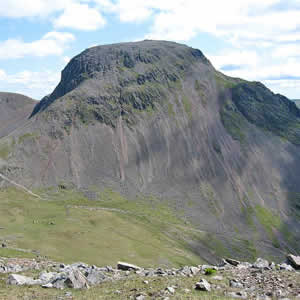
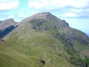
As well as its woods, Ennerdale can also boast a fine collection of hills and crags. Peaks like Great Gable and High Crag are easily visible from just about anywhere in the valley. To the south is a mountain called Pillar, the 8th-highest in the Lake District. It features a classic climbing route that should be attempted by experts only! |
|||||
|
|||||
|
|||||
In the year 1810, the Ennerdale valley was put under siege by a mysterious and unknown creature. Several hundred sheep were mauled to death in a series of bloody, horrific, violent attacks. The beast became known as the Girt Dog of Ennerdale, although no-one really knew if it was a dog, a large cat, or something else. Children were kept indoors for their safety, and the local farmers set out to hunt and kill the monster. However, the Girt Dog seemed to easily evade all their traps, and rumours grew that it possessed some evil sorcerous power. Professional hunters from all over the country came to Ennerdale to join the search. Finally, after many weeks, they cornered the beast, deep inside the woods. It was a long and desperate battle, but with a combination of guns and hunting dogs, the farmers were finally able to kill the monster. On examination of the corpse, the hunters were still unsure what the beast was, but it appeared to be a cross between a tiger and a wolf! So it could possibly have been the now extinct Tasmanian Devil. |
|||||
Nowadays Ennerdale is a perfectly safe place, but it still requires a bit of determination to get there. However, once you've made it, you'll be treated to sights that most visitors to the lakes will never see. |
|||||
|
|||||
You can ascend Great Gable from most directions. The most popular route is via Wasdale Head, which has parking. |
|||||
Pillar is usually walked from Wasdale Head which is by far the nearest road access. |
|||||
 |
|||||
|
Pocket Britain is optimised for use on a smartphone or tablet with internet access. All content is subject to copyright. All reasonable methods have been used to ensure information supplied is accurate at the time of publication. However, it is advisable to check information before relying on it. Privacy Policy |