Settle |
|
Settle |
|
|||
 |
|||
Britain > North Yorkshire > Settle |
A North Yorkshire town adjacent to the largest collection of limestone in the country |
Listen to this article |
Settle is a town in Ribbesdale, North Yorkshire. It's a nice place to shop, with lots of locally-owned businesses, and a weekly market every Tuesday. The main square has a building called the Shambles, which has a series of pretty stone arches, and two storeys of shops. Despite these attractions though, the real reason that people come to Settle is to see the incredible scenery that surrounds it. The town is within the Yorkshire Dales National Park, one of the largest protected areas in Britain. |
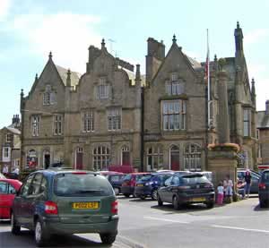 The centre of Settle Photo in the public domain |
More specifically, Settle is on the edge of the largest collection of limestone in the country. This gives it a near-endless supply of cliffs, potholes and caves. The most obvious of these rock features is Castleberg Crag, a flagpole-topped cliff that looms over the town. Until very recently, this was closed to the public, because of the dangers of falling rocks. But in the summer of 2009, the Crag was cleared up, made safe, and opened as a climbing venue, with 24 different routes to the top. |
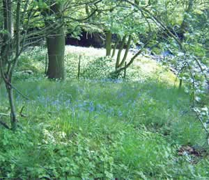
Just a little further afield, there's another cliff called Attermire Scar, with great views over the dales. This area is home to several caverns, such as Victoria Cave, which was discovered by complete chance in 1837. Within its depths, there were animal bones believed to be up to 130,000 years old. There's nothing to stop you exploring the caves yourself, but as the numerous warning signs will agree, doing so can be very dangerous! |
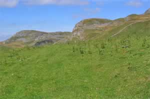 The area around Attermire Scar Photo Mick Melvin |
Don't worry though, because even without the caves, it's difficult to run out of interesting things to see in the Yorkshire Dales. Many walkers aim for one of the area's waterfalls, such as Stainforth Force, to the north. Another is Scaleber Force, a multi-levelled falls surrounded by green moss. A third is Catrigg Force, which is hidden away in a secret copse. |
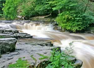 Stainforth Falls Photo ahisgett |
Directly next to Settle is the Forest of Bowland, which spreads out west to cover much of Lancashire. This isn't part of the Yorkshire Dales National Park, but it is an official Area Of Natural Beauty in its own right. It's stuffed full of attractive villages, great scenery, and endless walking opportunities. |
 Part of the Forest of Bowland Photo Andrew Webster |
Also within reach of Settle are the mountains of Whernside, Ingleborough, and Pen-y-ghent, which are collectively known as the Yorkshire Three Peaks. A popular challenge for walkers is to try and reach the summit of all three within 12 hours. The journey, which traditionally begins at the village of Horton-in-Ribbesdale, is around 40 kilometres long. |
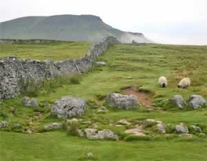 Starting the ascent of Pen-y-ghent Photo Gutsibikes |
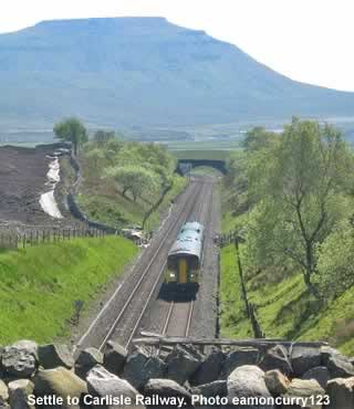
There's a lot of scenery to see and a lot of different ways to see it. You can explore the dales on foot, on horseback, by boat, by canoe, by bicycle or even by balloon. One other extremely popular way to see the local landscape is by train, via the Settle-Carlisle Railway. The line between these two towns was one of the major achievements of Victorian engineering. This 117-kilometre route is usually agreed to be the most scenic on the entire National Rail network. It passes over huge viaducts and through gentle hills, offering a unique view of the dales and all the sights they have to offer. |
 The Settle to Carlisle Railway Photo Neil T |
 |
|
Pocket Britain is optimised for use on a smartphone or tablet with internet access. All content is subject to copyright. All reasonable methods have been used to ensure information supplied is accurate at the time of publication. However, it is advisable to check information before relying on it. Privacy Policy |